|
Feb 03: CW rotation continues with little net translaion
Jan 28: Good clear
image from 27 Jan on the RPSC site shows continued rotation
C19 oriented nearly N-S. Jan 24: After nearly one week without imagery
due to cloud cover, RPSC released an image with C-19 barely visible
through light clouds. More rotation is evident. The SE corner
of C-19 is not visible in the RPSC images, so it's position was
estimated by extrapolation. Jan 15-20 2003: C-19 showing significant motion,
mostly rotation CW. This is most apparent in the images
provided by RPSC [ orig figure
with ellipses was archived in favor of newer outline rendering
at right. ] Jan 02: Some commentary
by D. MacAyeal on C-19, plus some related publications Dec 20: view expanded
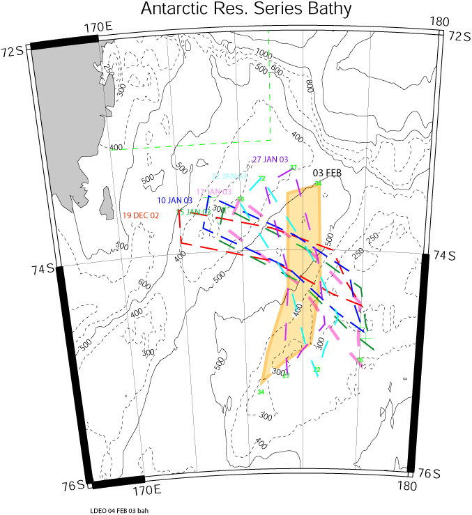
scale map with bathymetry from Antarctic Research Series
American Geophysical Union - Antarctic Research Series Dec 17: no significant motion over the last
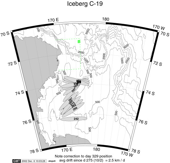
2 weeks, so map has not been updated Dec 06: updated to reflect correction to day
329 position . Examination of the images from RPSC confirm that
the NIC position of -73.4 174 for day 329 is in error. I have
set it to -73.8 174 in our files. The berg has not moved much
since day 323. Dec 04 2002: Iceberg C-19 is approaching the
Anslope work area. Approximately weekly
positions of C-19 posted by the National Ice Center (NIC)
are used in this schematic figure to track the berg's progress.
The ellipses are 109 x 17 nmile, and are labeled with the year-day
of the NIC position. Orientation is approximately that of C-19
based on images provided
by RPSC. Box "B" (in green ) from the Anslope proposal
encloses the proposed mooring sites. This figure will be updated
as new positions become available. |
|
Figure at right displays C-19 outlines hand-digitized from the RPSC OLS images from days indicated. Bathymetry from ARS 68 (see above for complete ref) [ pdf version -best quality with Acrobat Reader 5] |