 |
|
LAMONT-DOHERTY EARTH OBSERVATORY THE EARTH INSTITUTE AT COLUMBIA UNIVERSITY |
|
| Drought Research | |

|
El Niño
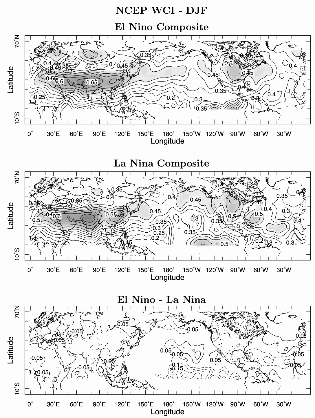
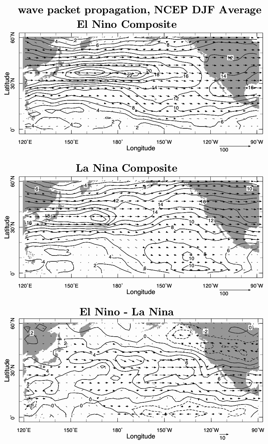
winters? It is well known that El Niños and La Niñas influence precipitation over the North Pacific Ocean and North America. These changes are commonly linked to changes in the latitude and longitudinal extent of the Pacific storm track. During El Niño events there is a tendency for increased precipitation over central and southern California, northern Mexico and the southern United States and reduced precipitation in the Pacific Northwest and British Columbia. The climatological Pacific storm track - the region of preferred propagation of storm systems - heads eastward from Japan and, when it reaches the eastern Pacific, tends to move northeastward. Consistent with the precipitation variations, during El Niño winters the storm track tends to maintain an eastward route from the central Pacific and head into southwestern North America while, during La Niña winters, the northeastward deflection over the eastern Pacific is exaggerated. These changes in the storm track are fundamental to creating seasonal precipitation anomalies and long terms droughts. Although this association between the El Niño-Southern Oscillation (ENSO), the Pacific storm track and the all-important precipitation anomalies over North America has been known for some two decades or more the causes of the linkages have always been a little obscure. It is clearly linked to changes in tropical Pacific sea surface temperatures (SSTs) and patterns of atmospheric heating. During El Niño events, for example, warming of the eastern equatorial Pacific Ocean moves atmospheric convection eastward. Anomalous rising motion in the eastward shifted convection region forces twin upper troposphere anticyclones straddling the equator. Anomalous westerly flow on the poleward flanks of these upper level anticyclones - at about 20N and 20S - shifts the subtropical jet equatorward in both hemispheres. But how does this impact the storm track? Back in a 2003 paper (Seager et al., 2003) and a follow up paper (Seager et al., 2005), we suggested that this worked through the way the tropically forced changes in the mean flow steered the transient eddies - the storms systems. In this new paper, in QJRMS (Seager et al., 2010), we examine this in detail using observations, GCMs and idealized model simulations. Analysis of daily data makes clear that during El Niños storm systems take a very zonal route across the Pacific and tend to move directly into the southern United States and Mexico. During La Niñas storm systems tend to take a more northeastward track while there is an additional leak of wave energy from the central Pacific towards the eastern equatorial Pacific, thus reducing incidence of storm systems moving into the Southwest. Some results are shown in Figure 1:
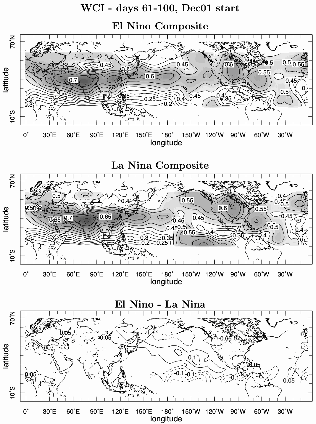
These altered paths of wave propagation can be seen in analysis of wave packets as well as of individual systems (Figure 2). We can also reproduce the same storm track changes in a GCM forced by tropical Pacific SSTs alone (Figure 3).
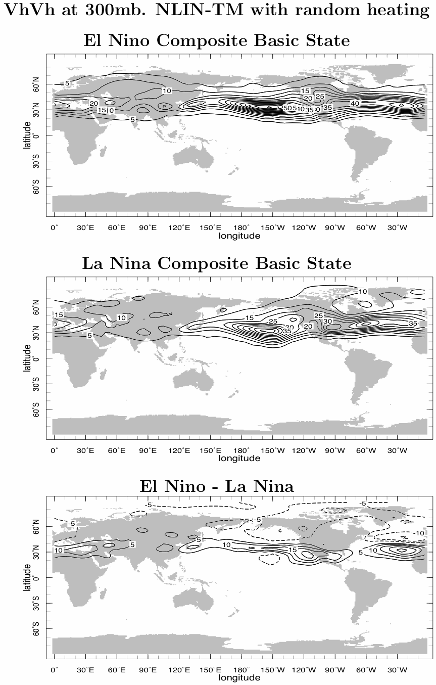
This makes clear that the changes are forced by the tropical Pacific SSTs and then involve an atmosphere wave-mean flow interaction with no subsequent involvement of extratropical SST anomalies. Idealized model simulations are then used to try to explain how this occurs. First we created a 'storm track model'. In this model the mean flow is specified and the model computes departures of the flow from this specified mean state. The model was randomly stirred over Asia to 'seed' disturbances that developed into storm systems that propagated east across the Pacific Ocean. By changing the specified mean flow - i.e. by imposing a basic state typical of El Niño winters and then a basic state typical of La Niña winters - we can see the influence that changes in the mean state have on transient eddy propagation paths. We find that the El Niño basic state clearly favored a more southward and eastward extended storm track while the La Niña basic state favored the northeastward propagation path. These results are interpreted in terms of the differing refractive properties of the different basic states. Much as waves in the ocean are refracted as they propagate across sand bars, storm systems are refracted as they move through a spatially varying mean flow. The southward displaced subtropical jet caused by tropical heating anomalies during El Niño winters causes the storm systems to refract equatorward relative to those during a La Niña winter. Here we show a movie of the paths of wave propagation for the La Niña basic state (top) and the El Niño basic state (bottom) as well as accumulated eddy statistics of meridional wind variance in the upper troposphere (Figure 4). REFERENCES
|
|
|||||
LDEO home | search | ocp webmaster
Copyright © 2011 by The Trustees of Columbia University in the City of New York, Lamont-Doherty Earth Observatory.
All rights reserved.
